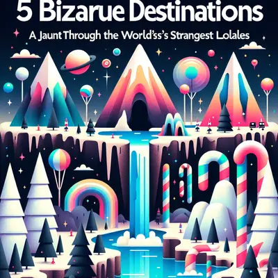
Some places don’t just feel “off the beaten path”—they feel like you’ve stepped off the map entirely and wandered into a glitch in reality. They’re not fictional, not forbidden (mostly), but they do mess with your instincts, your GPS, and your definition of “normal.”
This is your unofficial field guide to five very real, very strange travel discoveries—places where borders get blurry, physics feels negotiable, and the landscape looks like it’s been beta-tested. None of these are your classic “top 10 weird spots” fodder. These are locations where adventurous travelers can actually go, stand there, and think: “I absolutely shouldn’t be here… and yet, here I am.”
The Town That Forgets Which Country It’s In: Baarle-Hertog / Baarle-Nassau
Welcome to the cartographer’s panic attack. On paper, Baarle-Hertog (Belgium) and Baarle-Nassau (Netherlands) look like someone dropped a puzzle on the floor and called it a border agreement. In reality, it’s even stranger.
The town is carved into dozens of overlapping enclaves and counter-enclaves. You can sit in a café with your left foot in Belgium and your right in the Netherlands, and your table technically obeys a different tax system than your chair. White crosses on the ground and plaques on buildings mark which country you’re in at this exact centimeter.
Shops literally move their front doors a few meters when laws change to fall under the more favorable country. During COVID, some businesses had half their space legally “open” and half “closed” because Dutch and Belgian rules didn’t match. Imagine ordering a beer in one country and walking three steps to legally drink it in another.
Why it’s worth your passport’s confusion:
- You can trace borders by walking the in-ground markers like a real-world video game.
- Local guides and maps tell absurd stories about neighbors who technically live in different nations but share a driveway.
- It’s one of the only towns where “Where are we?” is not a dumb question—it’s a geographic crisis.
The Country That Lives in Superposition: Bir Tawil, the Land Nobody Wants
In a world where every rock on a border gets argued over, Bir Tawil stands alone: a patch of Earth that neither Egypt nor Sudan actually claims. No passport stamp. No government. No native population. Just sand, heat, and the pure chaos of unclaimed land.
Bir Tawil exists because of a century-old mess-up between two border definitions—one drawn in 1899, another in 1902. Each country claims the map that gives them the more desirable strip of land elsewhere (the Hala’ib Triangle), and in the process, both shrug off the 2,000-square-kilometer afterthought that is Bir Tawil. Result: a legal oddball that’s technically terra nullius—land without a state.
You can’t just declare yourself king and be taken seriously (sorry, internet micronation hopefuls), but the notion that you can stand in a modern “unclaimed” space is surreal. No roads, no official border posts, no visas—just desert, disputed maps, and maybe a satellite ping as your only witness.
Why it’s a wild mental trip:
- It exposes how arbitrary modern borders really are—down to cartographic clerical errors.
- You’re in a place that exists but isn’t “anybody’s” in the nation-state sense.
- Getting there requires serious logistics, permits for surrounding territory, and a high tolerance for heat, risk, and red tape.
Note: This is an extreme expedition. Overland access requires crossing very real, very controlled borders first. Think expedition-level planning, local fixers, and a questionable relationship with comfort.
The Village Where Gravity Is Suspicious: Magnetic Hill, Near Leh, India
On the road to Leh in India’s Ladakh region, there’s a scrap of highway that refuses to obey your understanding of gravity. Park your vehicle in the marked spot, put it in neutral, and watch as it seemingly rolls uphill at about 20 km/h. Welcome to Magnetic Hill, the kind of roadside anomaly that feels like a prank by the universe.
Officially, it’s an optical illusion: the surrounding landscape messes with your depth perception so the downhill slope looks like an uphill climb. Unofficially, when you’re standing there in thinning Himalayan air watching unmanned cars creep “up,” you’ll briefly believe in magnetic fields, secret military tech, or low-level wizardry.
What makes this more than a tourist gimmick is the setting. Ladakh is already otherworldly—high-altitude moonscapes, monasteries glued to cliffs, air so thin your lungs file complaints. The presence of a pseudo-paranormal road in the middle of all that just feels correct, like the mountains are trolling everyone.
Why it’s worth riding neutral:
- You get a gravity-bending party trick in the middle of genuinely epic Himalayan scenery.
- The phenomenon is a fascinating lesson in how easily human perception can be hacked by terrain.
- It’s a perfect stop on a Leh road trip, especially if you like your landscapes with a side of “Are you seeing this too?”
The Volcano That Burns Blue: Kawah Ijen, Java, Indonesia
At night, the crater of Kawah Ijen looks like someone left a portal to another dimension slightly ajar. Electric-blue flames lick the dark volcanic walls, neon rivers appear to flow under the rocks, and sulfur smoke chokes the air. It’s not CGI. It’s chemistry.
Kawah Ijen’s “blue lava” is actually sulfuric gas, igniting when it hits the open air at high temperature—up to 600°C. The gas burns like a blowtorch, and condensed sulfur glows an eerie blue along the slopes. To see it, you start hiking around midnight, climbing in the dark with a headlamp while clouds of sulfur stew in the crater.
What makes this place intense isn’t just the visuals; it’s the context. While travelers gawk at the flames, sulfur miners haul 60–80 kg loads of solid sulfur out of the crater—by hand. No fancy gear, just baskets and brutal endurance. The place is a science museum, a nightmare, and a workplace all at once.
Why blue fire belongs on your reality-bending list:
- It’s one of the only places on Earth where you can witness such sustained blue volcanic flames.
- You’re literally inside an active volcano’s crater with a caustic acid lake nearby.
- It forces you to confront the human side of “epic travel shots”—the miners working inside your Instagram moment.
Non-negotiable: gas mask or at least a serious respirator, and a guide who knows the current conditions. The sulfur fumes are not a quirky detail; they’re hazardous.
The Border That Won’t Commit: Diomede Islands Between “Today” and “Tomorrow”
In the Bering Strait sit two islands staring each other down: Big Diomede (Russia) and Little Diomede (USA). They’re only about 3.8 km apart, but the International Date Line slices between them, so they’re almost a full day apart in time. Stand on Little Diomede and you can literally look at “tomorrow” across the water.
Big Diomede is a Russian military zone with no civilian population; Little Diomede hosts a small Inupiat community and a rugged, ice-framed village clinging to the rock. For most travelers, you’ll never set foot on either island—this is National Geographic-level remoteness. But just knowing they exist does something weird to your sense of geography.
If you manage to get close—via specialist expedition cruise or extreme Arctic adventure—you’re traveling to a place where the border is invisible, the time difference is surreal, and politics and ice have divided two islands that share culture, history, and weather but not a present tense.
Why it haunts adventurous minds:
- It physicalizes time zones: “yesterday” and “tomorrow” in eyeshot of each other.
- It’s a stark look at how arbitrary and absolute international lines can be.
- The remoteness is total—this is the edge-of-the-map energy most places only pretend to have.
Conclusion
The world’s not short on “weird attractions.” But these five aren’t just odd—they’re structurally, politically, or physically wrong in ways that make your brain reboot. Towns that zigzag through nations. Land nobody wants. Roads that fake out gravity. Volcanoes that burn neon. Islands separated not just by water, but by time itself.
If you chase these kinds of places, you’re not just collecting stamps; you’re stress-testing the rules you assume about the planet—borders, maps, physics, ownership, even time. Pack curiosity, respect, and a healthy distrust of what you think you know. The map is only a rumor. The world is much stranger.
Sources
- [Government of the Netherlands – Baarle-Nassau Information](https://www.government.nl/topics/municipalities/baarle-nassau) – Background on the municipality and its unique border situation
- [BBC Travel: “The Border Anomaly of Baarle”](https://www.bbc.com/travel/article/20190708-the-strangest-border-town-in-the-world) – In-depth look at the complex enclave puzzle of Baarle-Hertog/Baarle-Nassau
- [U.S. Geological Survey (USGS) – Volcanic Gases and Their Effects](https://volcanoes.usgs.gov/vhp/gas.html) – Scientific context for volcanic gases like those at Kawah Ijen
- [Smithsonian Magazine: Kawah Ijen’s Blue Fire](https://www.smithsonianmag.com/travel/blue-fire-kawah-ijen-volcano-indonesia-180950199/) – Explanation of the “blue lava” phenomenon and working conditions of sulfur miners
- [NOAA National Ocean Service – International Date Line](https://oceanservice.noaa.gov/facts/international-date-line.html) – Clear explanation of how the International Date Line works, relevant to the Diomede Islands’ time gap
Key Takeaway
The most important thing to remember from this article is that this information can change how you think about Weird Places.